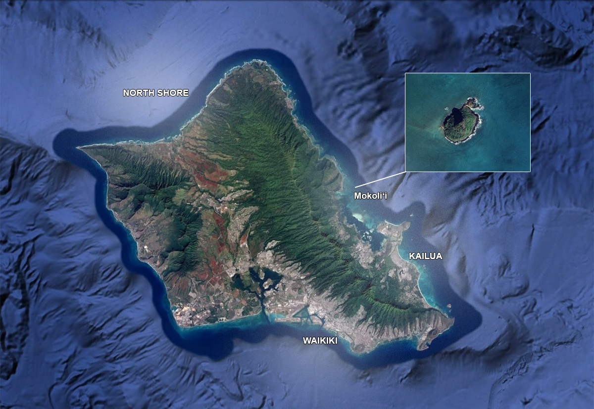
Mokoliʻi Island sits just offshore on the windward side of Oahu. The island rises from Kāneʻohe Bay is best known for its steep, narrow ridge dramatic shape. Many visitors also call it Chinaman’s Hat because of its profile.
The island is located directly across from Kualoa Regional Park along the scenic coastal stretch of Kamehameha Highway (HI-83). From the shoreline, the island appears close. However, it is still offshore, ocean conditions play a major role in access safety.
Mokoliʻi Island is positioned about:
- 45 minutes from Waikiki
- 35–40 minutes from Honolulu (without traffic)
- 1 hour from the North Shore
How to Get to Mokoliʻi Island by Car
Parking is available at Kualoa Regional Park. Always park in designated areas.
From Waikiki or Honolulu
Drive east toward Kāneʻohe. After passing through the H-3 or Likelike Highway route, continue north along Kamehameha Highway (HI-83). You will follow the coast with ocean views on your right. The island becomes clearly visible as you approach Kualoa.
From the North Shore
Drive south along HI-83. The route follows the coastline offers scenic mountain ocean views. As you near Kualoa, the island will appear just offshore.
Mokoliʻi Island is easy to find on a map simple to reach by car. The main planning factor is not navigation, but ocean conditions. The island may look close, yet it remains an offshore feature exposed to wind tide.
For most visitors, the shoreline view from Kualoa Regional Park delivers the full experience. Clear directions, safe parking, realistic expectations make planning straightforward.